 Authorization: Flood Control Act approved June 22, 1936; Project Document HD 308, 74th Congress, 1st Session.
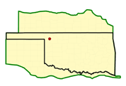
Location: At river mile 5.5 on Wolf Creek, a tributary of the North Canadian River, about one mile south of Fort Supply, Oklahoma, and about 12 miles northwest of Woodward in Woodward County, Oklahoma.
Status: Complete.
Purpose: Flood control and conservation storage. (Water supply is included in the conservation storage purpose.)
History of Construction: Construction began in October 1938 and was completed in May 1942. Embankment closure started in January 1941 and was completed in August 1941. Impoundment of the conservation pool was started and completed in May 1942. The project was completed for full flood control operation in May 1942.
Type of Structure: The structure is a rolled earth-filled dam 11,865 feet long which rises to a maximum height of 85 feet above the streambed.
Spillway & Outlet Works: An uncontrolled, concrete, chute-type spillway is located in the left abutment. Crest length of the spillway weir is 540 feet. Spillway capacity is 210,000 cubic feet per second (cfs) at the maximum pool (elevation 2050.3). The outlet works are located in the left abutment between the dam and the spillway and consist of a gate tower structure and an egg-shaped conduit having an area approximately equivalent to a circular section 17.7 feet in diameter. The lower end of the conduit discharges into a stilling basin adjacent to the right training wall of the spillway. Capacity of the outlet works varies from 4,940 cfs at the conservation pool elevation to 11,500 cfs at the maximum pool elevation. Flow through the outlet works is controlled by three 7-foot 6-inch by 16-foot electrically-operated vertical lift gates. A 36-inch gated bypass pipe affords control of low flow discharges. Bank-full capacity on the North Canadian River at Woodward, Oklahoma, is about 1,700 cfs.
Hydrologic Data: The flood of record occurred in June 1957, and the estimated peak discharge and volume were 73,000 cfs and 91,650 acre- feet, respectively. Runoff from the drainage area above the site during that storm was 1.15 inches.