 Authorization: Flood Control Act approved June 22, 1936, as amended by the Flood Control Act approved May 17, 1950; Project Document HD 308, 74th Congress, 1st Session.
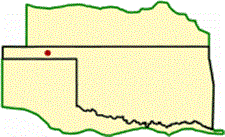
Location: On the North Canadian River at river mile 623.2, about 4.5 miles northeast of Hardesty in Texas County, Oklahoma.
Purpose: Flood control, water supply, recreation, and fish and wildlife.
Status: Complete.
History of Construction: Construction began in March 1966 and impoundment began in October 1978. Construction was completed in 1978.
Type of Structure: The structure is a rolled earth-filled embankment having a total crest length of about 15,200 feet and rising to a maximum height of about 120 feet above the streambed. A roadway is located across the top of the dam.
Spillway & Outlet Works: An uncontrolled, emergency spillway about 1,500-feet-wide is constructed on the right abutment with a crest elevation of 2796.0. Spillway capacity at maximum pool is 359,000 cubic feet per second (cfs). The outlet works are located near the right abutment and consist of a concrete gate tower with a 12-foot by 16-foot 5-inch oblong conduit. Discharge through the conduit is controlled by two 5.67-foot by 16.5-foot, drum, hoist-operated tractor-type service gates. A 36-inch low-flow bypass and a 24- inch water supply line are incorporated in the outlet works. The capacity of the outlet works is 7,100 at top of flood control pool.
Hydrologic Data: Peak flow, which occurred during the September 1941 flood (pre-construction), amounted to 44,200 cfs. The largest volume, which occurred during the October 1923 flood (pre-construction), amounted to 109,000 acre-feet and is equivalent to 0.87 of an inch of runoff from the contributing drainage area above the dam site.