 Authorization:
 A part of the McClellan-Kerr Arkansas River Navigation System in the River and Harbor Act approved July 24, 1946; Project Document HD 758, 79th Congress, 2d Session.
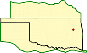
Location: The lock is on the Verdigris River at McClellan-Kerr navigation mile 401.4, about 4 miles northwest of Okay in Wagoner County, Oklahoma. The dam is in the old river channel at navigation mile 403.0.
Status: Completed
Purpose: Navigation, recreation, and fish and wildlife.
History of Construction: Construction began in July 1966 and impoundment began on December 2, 1970. The lock and dam became operational for navigation on December 26, 1970.
Type of Structure: The structure is a combined earth-filled and concrete, gravity dam. The total dam length is 11,690 feet.
Spillway & Outlet Works: The spillway is a gated, concrete, ogee weir with a crest elevation of 485.0 and with left and right uncontrolled overflow sections. The spillway has a total width of 386 feet with a net flow width of 346 feet. The left and right uncontrolled overflow sections of the spillway are separated by three 60- by 27-foot tainter gates with l0-foot-wide concrete piers. In addition, the left and right embankments are designed to overflow with lengths of 280 and 2,700 feet, respectively. A 24-foot-wide service bridge is constructed on the piers for access to the lock.
Lock: The lock has a 110- by 600-foot chamber of the single-lift type with miter gates. The lock has a 21-foot normal lift and a 24-foot maximum lift.