Authorization: Flood Control Act approved August 18, 1941; incorporated in the Arkansas River multipurpose plan by the River and Harbor Act of July 24, 1946; Project Document HD 107, 76th Congress, 1st Session; and the Water Resources Development Act of 1986, Public Law 99-662.
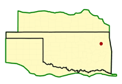
Location: On the Grand (Neosho) River at river mile 7.7, in Mayes, Wagoner, and Cherokee Counties, about 5 miles north of Fort Gibson, Oklahoma, and about 12 miles northeast of Muskogee, Oklahoma.
Status: Complete.
Purpose: Flood control, navigation, fish and wildlife, and hydroelectric power.
History of Construction: Construction began in 1942, was suspended during World War II, and resumed in May 1946. Closure of the embankment was completed in June 1949. The project became fully operational when the last of four generators started producing commercial power in September 1953.
Type of Structure: The dam includes two concrete-gravity non-overflow sections. One section, 285 feet long, extends from the spillway to the earth embankment at the right abutment. The other section, 460 feet long, extends from the intake structure to the earth embankment at the left abutment. The dam also includes two earth embankment sections, one of which extends about 374 feet from the natural ground at the right abutment to the right bank concrete non-overflow section. The other embankment, 63 feet long, extends from the left abutment to the left bank, concrete, non-overflow section. The powerhouse intake structure is located adjacent to the spillway on the left and is 318 feet long. The total length of the structures, including the spillway, is 2,990 feet, and the maximum height above the streambed is 110 feet. Oklahoma State Highway 251A extends across the top of the structures.
Two levees and seven dikes form parts of the entire Ft. Gibson project. Wyandotte Levee is located in Wyandotte, OK. Oklahoma Ordnance Works Levee (OOWL) is located in Pryor, OK. Dikes 1, 2, 3, 8, 9, and 11 prevent Fort Gibson pool from crossing over to the Verdigris River Basin during high lake levels. In addition, Dikes 1, 2, and 3 protect the town of Okay from Fort Gibson reservoir. Dike 10 protects the town of Wagoner, Oklahoma from the flood pools associated with Fort Gibson Lake. The seven rolled earth-filled dikes are located on the west side of the reservoir between Wagoner, Oklahoma and the dam, and have a total length of 21,678 feet. See the chart below for specifics on the dikes and levees.
Spillway & Outlet Works: The spillway section is a concrete-gravity, ogee weir that extends across the existing river channel and a major portion of the right bank floodplain. Spillway capacity is 986,000 cubic feet per second (cfs) at the top of the flood control pool. The spillway is equipped with thirty 40- by 35-foot tainter gates operated by individual electric-motored hoists. The total length of the spillway is 1,490 feet. Outlet works consist of ten 5-foot, 8-inch by 7-foot rectangular sluices located through the spillway weir. Capacity of the outlet works varies from 21,000 cfs at the flood control pool elevation with no spillway discharge to 14,400 cfs at the flood control pool elevation with the spillway discharging at full capacity. Flows through the sluices are controlled by a means of hydraulically-operated cast-iron slide gates. Emergency closure of the sluices can be accomplished using a bulkhead lowered by a hoist into frames provided at the sluice entrances. A 48-inch-diameter pipe is located through the right abutment of the dam for municipal water supply for the city of Muskogee. Bank-full capacity on the Grand (Neosho) River below the dam is about 100,000 cfs.
Hydrologic Data: Estimated peak discharge and volume for the flood of May 7 to June 1, 1943, (with Grand Lake O' the Cherokees only in operation), were 400,000 cfs and 5,918,000 acre-feet, respectively. Total runoff from the drainage area above the dam site was 8.88 inches.